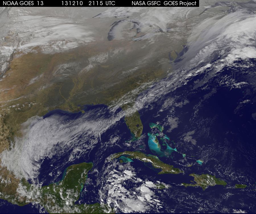
It was another snowy and messy day in the mid-Atlantic. The federal government even decided to close offices in the DC area. Here is an image from earlier showing the storm stretched out along the east coast as it moves off to sea. You can also see some nice lake effect snow to the east of Great Lakes.
I love following the storm forecasts and tracking the weather as it moves through. There’s no shortage of websites where you can do this, but one of my favorites, and certainly the one of the most most visually pleasing is called Forecast. It’s a weather app that works on your computer or smartphone, and, among other things, produces beautiful radar images and animations. You can view and toggle the radar animations to look into the past or at future predictions. For example, here is a video of me playing with Forecast this morning. I start of the present (red line), go back in time a few days, and then let the animation play to show the approaching storm. After the red line the animation shows predicted weather patterns.
The developers of forecast have another tool called Quicksilver, an ambitious project which will be amazing if it works. The idea is to use many sources of weather data, including satellites, ground stations, and weather models and combine it with local topography and microclimates to create an extremely high resolution global temperature model. So you might know that the temperature will be 50 degrees in town, but this tool allows you to predict what the temperature would be 25 miles away in a particular valley in the mountains. The image below shows a visualization of the Quicksilver data in the southwest United States. You can see that it’s 90 in Phoenix and 50 in Flagstaff, but you can also see lots of interesting details like the cold patch on the north rim of the grand canyon and the warm bit that follows the floor of the length of the canyon. You can download this data an enormous raster file and do all sorts of things with it. The big unknown is how well it actually works. I’m not sure if the developers have some sort of ground truthing program, but I think that’s needed.

Finally, the makers of Forecast have an iOS app called Dark Sky. It’s supposed to use their forecast models and your location to send you a warning just before precipitation is expected to hit your area. It’s a great idea, but the value is all in the quality of the execution. Does it really work. It’s a paid app and I have not yet shelled out the money to find out for myself.
